Wednesday, December 29, 2021

Updated Website Highlights Community-informed Vision for Bronx Neighborhoods around New Metro-North Stations


Planning work describes potential housing, economic and infrastructure opportunities to support now-funded stations coming to Hunts Point, Parkchester/Van Nest, Morris Park and Co-op City

  Department of City Planning (DCP) Director Anita Laremont today announced the release of community-informed planning work that is based on a year of public input on the future of four East Bronx neighborhoods set to receive new Metro-North stations.

“We couldn’t be happier to share our recommendations for these four communities, soon to be home to brand new Metro-North stations. This once-in-a-lifetime opportunity to vastly improve transit access in the East Bronx, and the region as a whole, is also a chance to improve the lives of the residents and businesses that call these neighborhoods home. We look forward to delving deeper into these proposals with local stakeholders and working towards a more accessible and more vibrant East Bronx together,” said DCP Director Anita Laremont

“We are proud to continue to work with the East Bronx community and DCP to bring transit access and create jobs for Bronx residents,” said NYC Economic Development Corporation (NYCEDC) President and CEO Rachel Loeb. “By offering a thoughtful and inclusive community engagement tool, New Yorkers will be able to share their input about what matters most to them for projects across the city.”

Because the stations, coming to Hunts Point, Parkchester/Van Nest, Morris Park and Co-op City, are now fully funded, community input and planning for the surrounding neighborhoods are more important than ever. DCP’s updated website seeks to encourage continued community input and refinement of the planning process aimed at ensuring the stations serve the local communities. 

The new stations are set to begin construction next year and open in 2026, after completion of the Penn Station Access project, which will provide Metro-North riders with a direct route into Manhattan’s Penn Station, reducing commute times by up to two-thirds to and from the East Bronx.

Community planning for the areas around the four stations seeks to guide and support investment in affordable housing, jobs, parks, and schools, among other necessary amenities and services. This planning is guided by the City’s equity and COVID-19 recovery goals.

Included in the vision documents are community recommendations for a new plaza at the Morris Park station; improvements to make walking under the Bruckner Expressway at Hunts Point more inviting; safety and lighting improvements to and from the station along Erskine Ave at Co-op City; and making E Tremont Ave at the Parkchester/Van Nest station a more active street that brings neighborhoods together.

These recommendations grew out of extensive public engagement that started in 2018, with hundreds of residents, business owners, workers, and local institutions taking part. DCP has worked alongside the MTA, Bronx Borough President Ruben Diaz Jr., the NYC Department of Transportation, NYCEDC, Community Boards 2, 9, and 11, and others to advance discussions on the new stations via in-person and remote workshops, meetings, open houses and additional events with community members and City agencies concerning the transit-accessible project.

This latest webpage update ensures transparency and ample opportunities for further discussion in these ongoing planning processes. While the MTA is set to begin construction on the stations in 2022, the Bronx Metro-North Study team will be working to update recommendations based on all the feedback heard in 2021, to be followed by additional public outreach in the spring. This will be an important step as we seek to ensure our Bronx neighborhoods are ready for the new service.

“We are thrilled that the Bronx is getting four new Metro-North stations, providing expanded access to safe and reliable public transit options,” said Lisa Sorin, President of The New Bronx Chamber of Commerce. “We encourage all those who live, work and own businesses in and around Hunts Point, Parkchester/Van Nest, Morris Park, & Co-Op City to visit nyc.gov/planning, participate and stay involved in the planning process to ensure ample community representation.”

“Montefiore and Einstein look forward to continued collaboration with DCP and the Morris Park community in the planning process for this transformative project. The community engagement process will ensure best outcomes for future generations to receive world class health care and education.  These recommendations around the new stations will ensure community needs are addressed and rules are established to attract economic opportunities for the East Bronx and beyond,” said Rick Chandler, Senior Vice President, Strategic Development, Montefiore Health System.

“The Morris Park community and commercial corridor are excited for this new step forward towards having direct Metro North connection to Manhattan, but also to Westchester and Connecticut. We encourage residents and businesses alike to continue reviewing the updated DCP project website, and use it as the avenue for conveying the community’s own vision for the comprehensive infrastructure improvements, that this project has a unique and unparalleled opportunity to create,” said Dr. Camelia Tepelus, Executive Director of the Morris Park Business Improvement District.

Department of City Planning
The Department of City Planning (DCP) plans for the strategic growth and development of the City through ground-up planning with communities, the development of land use policies and zoning regulations applicable citywide, and its contribution to the preparation of the City’s 10-year Capital Strategy. DCP promotes housing production and affordability, fosters economic development and coordinated investments in infrastructure and services, and supports resilient, sustainable communities across the five boroughs for a more equitable New York City.

In addition, DCP supports the City Planning Commission in its annual review of approximately 450 land use applications for a variety of discretionary approvals. The Department also assists both government agencies and the public by advising on strategic and capital planning and providing policy analysis, technical assistance and data relating to housing, transportation, communit

Bronx Metro-North: Thank you for helping to move the study forward in 2021!


Thank you for all your insights, feedback, and ideas in 2021!
 

The Bronx Metro-North Study (BMNS) Team and the Department of City Planning (DCP) would like to thank everyone who participated in our Remote Open House, Remote Workshops, and Remote Office Hours in 2021. Your insights, concerns, and vision will be critical in updating the draft plan to ensure that the station areas are ready for new planned service. 

Since launching our remote engagement:

  • 150+ Community Members have participated in our Remote Workshops and Remote Office Hours
  • 185+ Station-Area Surveys have been completed
  • 2,500+ visitors who have accessed our Remote Open House

This latest webpage update ensures transparency and ample opportunities for further discussion in these ongoing planning processes. Help Build the Plan!

While the MTA is set to begin construction on the stations in 2022, the Bronx Metro-North Station-Area Study team will be working to create a final plan based on all the feedback received throughout the process. The final plan will be an important step as we seek to ensure our Bronx neighborhoods are ready for the new service.
 
To read an important message from the Director of the Department of City Planning, Anita Laremont, click the link below. 
Message from the Director of City Planning, Anita Laremont
Questions?
To speak directly with planning staff, please sign up for our remote office hours by clicking below.
BMNS Office Hours Bookings


Metro-North is moving forward!

Following the uncertainties of 2020, this past year has been full of good news for Metro-North as they work to build and bring service to the planned stations. 

Earlier the this Metro-North learned that they had passed their environmental review process with flying colors. 


Construction will begin in 2022, making the station area planning all the more important as we move into the new year!

We're excited to to continue to work with you the community, Metro-North, and City and State agencies to ensure that the station areas are fully prepared for this exciting new service.
To read more about the draft plan, visit our Draft Plan overview to watch our station-area overview videos and to read our draft recommendations and more by clicking below.
 
Building the Draft Plan


4 Days and Counting


Only four days to go as your mayor. Here I am in the Bronx announcing my new Placard Patrol with Chief Chan as my henchman to give out tickets to cars with illegal placards. That lasted long, about one month until his squad was reassigned, and so was he. 


I got stuck with a lot of mandates from my predecessor Mayor Bloomberg, and I am going to stick incoming Mayor Adams with even more mandates that he will be stuck with. After the hurricane that devastated lower Manhattan years ago, I was suppose to do a lot of things, but I can blame not doing them on COVID-19. So Charlene make sure you took everything that was not nailed down.

DE BLASIO ADMINISTRATION RELEASES CLIMATE RESILIENCE PLAN FOR FINANCIAL DISTRICT AND SEAPORT


Sets New York City on path to protecting Lower Manhattan from the deadly and costly effects of climate change


 Mayor de Blasio, New York City Economic Development Corporation (NYCEDC) and the Mayor's Office of Climate Resiliency (MOCR) today released the Financial District and Seaport Climate Resilience Master Plan, a blueprint for comprehensive flood defense infrastructure to protect Lower Manhattan from the urgent threat of climate change. The plan, projected to cost $5 to $7 billion, reimagines the shoreline of Lower Manhattan and creates a resilient waterfront to withstand severe coastal storms and rising sea levels. Nearly one million people work in, live in, and commute through the low-lying Financial District and South Street Seaport neighborhoods. Illustrative images of the design proposal can be found here (credit: NYCEDC).


Protecting Lower Manhattan is imperative to New York City’s overall coastal resilience strategy.  It is one of the nation’s largest central business districts, with half of workers coming from the outer boroughs; a critical hub of the subways and PATH transit systems and the regional highway network; and an iconic destination for millions of visitors from around the US and the world. Using the New York City Panel on Climate Change 90th percentile projections, by the 2050s rising tides are projected to flood the Financial District and Seaport monthly, then daily by the 2080s. Some level of frequent tidal flooding is likely to be seen as early as the 2040s.


 “This Plan for a protected and resilient waterfront in Lower Manhattan will help us fully confront the urgent and accelerating threat of climate change,” said Mayor Bill de Blasio. “A recovery for all of us must ensure families, businesses, and communities in Lower Manhattan are able to withstand extreme weather and rising sea levels, which this vision guarantees.”


To protect the area, which was hard-hit by Hurricane Sandy in 2012, the master plan features a multilevel waterfront that extends the shoreline of the East River by up to 200 feet from its existing location. The upper level will be elevated by about 15 to 18 feet to protect against severe storms like Sandy, while doubling as public open spaces with sweeping views of the city and harbor. The lower level will be a continuous waterfront esplanade, raised three to five feet to protect against sea level rise while connecting New Yorkers to the water's edge. From now through 2100, if no action is taken, repetitive flooding is projected to cause up to $20 billion in estimated losses to the region. The master plan will safeguard Lower Manhattan in a time of rising sea levels and more frequent and intense coastal storms.


The master plan encompasses almost one mile of waterfront from The Battery to the Brooklyn Bridge. Notable features of the proposed plan include:


    Floodwalls buried in the landscape that create a line of ridges along this waterfront, permanently protecting Lower Manhattan from coastal storms and creating new open spaces with expansive views of the harbor

    Resilient stormwater infrastructure, including a new pump station along with green infrastructure

    Resilient ferry terminals for Staten Island, Governors Island, and NYC Ferries, among other operators

    Universally accessible entrances and pathways, designed to ensure people of all ages and abilities can get to and move around the waterfront

    New public open spaces with playgrounds, plazas, lawns, seating, and cafes

    Coves that promote habitat restoration and provide opportunities to learn about the ecology of the East River

    Resilient piers for docking historic ships, bolstering the historic character of South Street Seaport 


The City has worked closely with the community to shape this plan. Through numerous public meetings and workshops, an online engagement portal, youth outreach with local schools, and other creative forms of engagement, the City incorporated feedback at every step along the way. To maximize outside input, the City also formed the Climate Coalition for Lower Manhattan, a group of local and citywide stakeholders chaired by Elizabeth Yee, Executive Vice President and Chief of Staff at The Rockefeller Foundation, and Tammy Meltzer, Chairperson of Manhattan Community Board 1.


“NYCEDC and MOCR have envisioned a 21st-Century resilient waterfront that stands to be a model for other major cities,” said NYCEDC President and CEO Rachel Loeb. “We’ve done years of work, and we have the innovation. There’s no doubt climate change is here. Sea levels are rising, and stronger, more devastating storms will only continue, which is why we must protect our coastline and safeguard our vulnerable historic Seaport area and Financial District. If we do not take action now residents, businesses, and critical infrastructure are put in jeopardy. We must rely on strong partnerships at all levels of government to help implement this plan.”


“The FiDi & Seaport Climate Resilience Master Plan provides the vision and blueprint for a resilient waterfront that can withstand the impacts of future coastal storms and sea level rise,” said Jainey Bavishi, Director of the Mayor’s Office of Climate Resiliency. ”The Master Plan is a product of years of collaboration between MOCR, NYCEDC, numerous City agencies, elected officials, technical experts and most importantly, community members. We must get to the work of implementation without delay.”


"New York City’s future depends on us planning for the effects of coastal storms and sea level rise in vulnerable places,” said NYC Parks Commissioner Gabrielle Fialkoff. “This new master plan outlines a vision for transforming the shoreline in the Financial District and Seaport that prioritizes the need for public access and climate planning along Lower Manhattan's waterfront.”


Next year, the City will move forward with the next phase of design and engineering needed to apply for federal funding and obtain required permits from state and federal regulatory agencies. With funding and prioritization by the regulatory agencies, comprehensive flood protection could be in place by 2035. In October, Mayor de Blasio announced $110 million in City funding for Seaport Coastal Resilience, a new project to protect South Street Seaport—the lowest lying and most vulnerable part of the master plan study area.


The master plan was led by NYCEDC and MOCR in partnership with a host of City agencies. Technical and design support was provided by an interdisciplinary consulting team led by the Dutch engineering firm Arcadis.


The Financial District and Seaport Climate Resilience Master Plan is part of the larger Lower Manhattan Coastal Resiliency (LMCR) strategy, backed by over $900 million in City investments to protect Lower Manhattan from flooding. This includes active capital projects in Battery Park City, The Battery, and the Two Bridges neighborhood north of the Brooklyn Bridge. 


Housing Lottery Launches For Peninsula Building 1B In Hunts Point, The Bronx


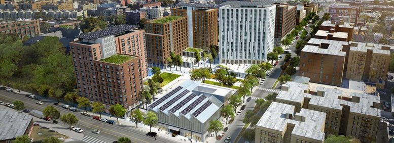
The Peninsula aerial view, design by WXY Architecture + Urban Design

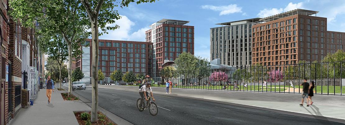
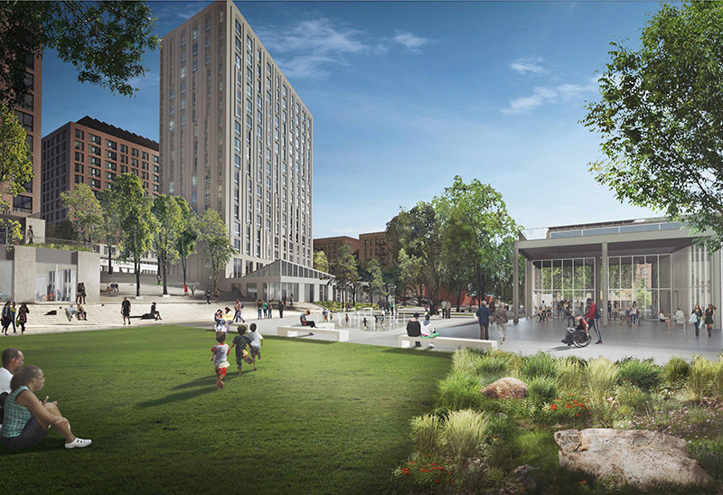
The affordable housing lottery has launched for Peninsula Building 1B, a 14-story mixed-use building at 720 Tiffany Street in Hunts Point, The Bronx. Designed by WXY Architecture + Urban Design and developed by the New York City Economic Development Corporation, the structure is the first of four new developments bringing 740 affordable units to the area. Available on NYC Housing Connect are 164 units for residents at 30 to 80 percent of the area median income (AMI), ranging in eligible income from $15,772 to $118,400.

Residents will have access to a wide range of amenities including an indoor community room with kitchenette, bike storage room, children’s playroom, shared laundry room, gym, and outdoor terrace. Rent includes heat and hot water, with tenants responsible for electricity.

Rendering of Peninsula in The Bronx

At 30 percent of the AMI, there are 18 units with a monthly rent ranging from $396 to $683 for incomes ranging from $15,772 to $44,400. At 40 percent of the AMI, there are 18 units with a monthly rent ranging from $549 to $949 for incomes ranging from $21,018 to $59,200. At 50 percent of the AMI, there are 18 units with a monthly rent ranging from $720 to $1,244 for incomes ranging from $26,880 to $74,000. At 60 percent of the AMI, there are 74 units with a monthly rent ranging from $908 to $1,570 for incomes ranging from $33,326 to $88,800. At 80 percent of the AMI, there are 36 units with a monthly rent ranging from $1,232 to $2,131 for incomes ranging from $44,435 to $118,400.

Prospective renters must meet income and household size requirements to apply for these apartments. Applications must be postmarked or submitted online no later than February 21, 2022.

Tuesday, December 28, 2021

Governor Hochul Signs Legislation to Improve Bicycle and Pedestrian Access at MTA Bridges and Passenger Stations


Legislation S.4943B/A.6235 Requires the MTA to Develop a Plan to Promote Cycling and Pedestrian Access on Bridges and Passenger Stations 

 
 Governor Kathy Hochul today signed legislation S.4943B/A.6235 which requires the Metropolitan Transportation Authority to develop a strategic plan to promote cycling and pedestrian access on its bridges and at its passenger stations and require the MTA to consider bicycle and pedestrian access in its capital plans. 

“Public transit in New York should be welcoming, safe and accessible for cyclists and pedestrians," Governor Hochul said. "I'm proud to sign legislation that will expand access to public transit, no matter how you choose to get around. This new law will make the MTA more walkable and bicycle-friendly, a major step in improving our transit system." 

Legislation S.4943B/A.6235 requires the MTA to make this plan to encourage cycling and pedestrian access on MTA bridges, bike parking at MTA subway and commuter rail stations, and bike access on board MTA equipment. Pursuant to the legislation, the Long Island Rail Road Commuter’s Council, the Metro-North Rail Commuter’s Council, and the New York City Transit Authority Council will study bicycle and pedestrian access and provide recommendations to the MTA regarding such. 

Albanian American Open Hand Association and Councilman Mark Gjonaj Toy Giveaway


Albanian American Open Hand Association and Councilman Mark Gjonaj Toy Giveaway

By Robert Press

Tuesday afternoon became a joyful time for many children who came to 2134 Barnes Avenue for the Albanian  American Open Hands Association and Councilman Mark Gjonaj Toy Giveaway. 


Hundreds of toys for boys and girls placed on tables by age group were waiting to go home with one of the many children who would get to take one home with them. 


First the children would meet Councilman Mark Gjonaj at the door where they would clean their hands with hand sanitizer, and then receive a candy cane. They would go down three stairs to find the toy they wanted, and then receive a hat and pair of gloves before being greeted by Santa Claus. There were also delicious Councilman Gjonaj doughnuts for all. 


To make sure the children's hands were clean, Councilman Gjonaj brought a big bottle of hand sanitizer and a bucket of candy canes.


Here one child points to the hand sanitizer leaking from the bottle.


Toys were set up on many tables for boys or girls, and by age group.


There were gloves and hats for the children courtesy of Councilman Gjonaj.


Santa is greeted by Violet Yueiiaj before he greets the children. 


This little girl was very happy to see Santa Claus.

Other children were happy to see Santa, and show off the toys they chose to go home with them.


Councilman Gjonaj, Miriam Quinn (sitting on Santa's lap, and Aleksander Nilaj of AAOHA.


Another photo with Santa, Councilman Gjonaj, AAOHA founder Aleksander Nilij and AAOHA volunteers. 

MAYOR DE BLASIO ANNOUNCES OPENING OF NEW NYC FERRY LANDING IN THROGS NECK, THE BRONX


Extended Soundview Route from Ferry Point Park now connecting more Bronx Commuters to the Upper East Side, Midtown and the Financial District, as network expansion continues


NYC Ferry’s five-borough system has served over 21 million riders since its 2017 launch


 Mayor Bill de Blasio and Rachel Loeb, President and CEO of New York City Economic Development Corporation (NYCEDC) today officially launched NYC Ferry service in Throgs Neck in the Bronx with the opening of a new landing at Ferry Point Park. The new facility extends the Soundview Route, which stops on the Upper East Side, in Midtown, and the Financial District. As of today, the route, now starts at the new landing in Ferry Point Park and continues to existing stops in Soundview, East 90th Street, 34th Street, Stuyvesant Cove, and Wall Street/Pier 11. From start to finish, the total traveling time is 60 minutes, shortening commutes for thousands of New Yorkers.


“The Throgs Neck ferry landing is a game changer for Bronx commuters,” said Mayor Bill de Blasio. “Starting tomorrow, this landing will provide affordable, accessible, and time saving transport, expanding transit options for all New Yorkers, further connecting the five boroughs and building a recovery for all of us.”


“NYC Ferry has become an integral part of New York City’s transportation system less than five years since its launch, and today we’re excited to bring service to Throgs Neck to help Bronx residents reach their workplaces and other destinations faster,” said NYCEDC President and CEO Rachel Loeb. “NYC Ferry ridership has outpaced expectations since the system first launched and ridership has recovered from the COVID crisis faster than any other mode of transit. We are proud this system is serving all five boroughs with safe, reliable, daily service, as we keep more New Yorkers with limited public transportation options moving.”


“The new NYC Ferry landing will expand access to Ferry Point Park and the Bronx waterfront while significantly improving public transportation options for the surrounding community,” said Parks Commissioner Gabrielle Fialkoff. “We look forward to seeing New Yorkers use this new ferry stop along with the park’s new pathways and public parking spaces, for years to come.”


On the extended Soundview route, vessels will continue to run every 40 minutes during peak times, and every 60 minutes during off-peak weekday times. The winter weekend schedule has vessels arriving every 75 minutes, though this will be more frequent in future summer weekend schedules. Residents of Throgs Neck will be able to reach E. 90th Street in 25 minutes and make the trip all the way to Wall Street/Pier 11 in 60 minutes, providing a one-seat ride that will cut many current commuting times by about 30 minutes. Detailed timetables for the Soundview route, along with a map of all NYC Ferry routes, can be viewed here.


The extension of the Soundview route is part of an announced NYC Ferry expansion plan that in August 2021 added the St. George route connecting Staten Island to Manhattan’s West Side, and will bring service to Coney Island, as well as year-round service to Governor's Island. 


The new Bronx landing is situated within Ferry Point Park, where a newly upgraded free parking lot is available to riders and park users. A small electric transit vehicle will be available, with preference to seniors and people with disabilities, to shuttle riders from the parking lot to the ferry landing.


“A thriving city requires us to consider new, alternative modes of transportation, as well as expansion to existing modes of transportation," said Bronx Borough President Ruben Diaz Jr. "Ferry service in Throgs Neck will provide commuters and visitors alike, an efficient and fun way to get from point a to point b and also explore The Bronx. I thank NYCEDC and the administration for their work to expand ferry service to Throgs Neck, and I look forward to seeing this service expand in the future."


“With the expansion of the Soundview ferry route into Ferry Point Park, commuters in the Northeast Bronx will now have faster and more reliable access to the Upper East Side, Midtown, and the Financial District without having to pay an exorbitant cost for convenience,” said Bronx Borough President-elect Vanessa L. Gibson. “This ferry line expansion is also another step forward towards decreasing transit deserts in our city and achieving greater transportation equity in our borough for residents that need it the most. I want to thank Mayor Bill de Blasio, the New York City Economic Development Corporation, Bronx Borough President Ruben Diaz Jr, and transportation advocates for their work on this project and I look forward to working with the new administration in pushing for more public transportation access in the Bronx.”


"The residents of the Eastern Bronx have suffered for years due to a lack of transportation access, and today the City finally delivers on its promise to increase ferry service within our community. It will also provide new transportation opportunities to residents that have struggled with hours-long commute rides into Manhattan,” said Council Member-elect, Marjorie Velazquez.


“This is a proud moment for the community of Throgs Neck! The NYC Ferry will take our residents to Manhattan in under an hour. Community Board #10 remains a transit desert and we could not be more grateful to have this wonderful addition to our transportation network. Thank you Mayor de Blasio and NYC EDC for this historic achievement for our community,” said CB10 District Manager Matthew Cruz.